Skip to content
Zomma Golf
Menu

Manakiki Golf Course is an 18-hole course in Willoughby Hills, Ohio.

Designed by Donald Ross. It plays 6,656 yards from the BLACK tees, rated 73.1/133 (checked 2026-08-21).

Create a free account to save Manakiki Golf Course to My Game, where every course you save is measured against the rest of its state on the figures it publishes.

18
holes
72
par
6,656
yards (tips)
133
slope (black)
The shape of the round · BLACK teespublished figures only
HOLE ORDER — BLACK TEES390378471393140568184443371430187504495381205329403384142435445365738494104113125135144153164174184PAROUT 3,338 YDSIN 3,318 YDSFIRST NINESECOND NINE
The published card in playing order, 18 holes with the two nines split — hole number under each bar, its par below that.

The course

designer
Donald Ross reported
address
35501 Eddy Road, Willoughby Hills, OH
elevation
790 ft derived
opened
1928
on site
driving range · putting green · restaurant · lessons · club rental

41.59590, -81.43266 — open on OpenStreetMap →

The course, from above

This map shows all 18 holes. 12 mapped features sit close to more than one hole and are drawn with the nearer one.

227 traced features across 8 layers for Manakiki Golf Course, drawn over NAIP 2023 aerial imagery.

Use arrow keys to pan, plus and minus to zoom. Tab reaches the map controls.

227 traced features across 8 layers for Manakiki Golf Course, drawn over NAIP 2023 aerial imagery. The map itself needs JavaScript; the geometry is a plain GeoJSON file either way.

18
Holes
26
Fairways
52
Bunkers
3
Water
18
Greens
60
Tee pads
6,656yds
BLACK tees
568yds
Longest hole
140yds
Shortest hole

Imported from OpenStreetMap, edges unchecked · USDA NAIP 2023-05-26

Tees & ratings

Yardagesfrom the clubchecked 2026-08-21

All 10 tee sets par, yardage, course rating, slope — the full table

Sorted by Yards, descending. 10 rows, showing the start of the table.

BLACKM72665673.1from the club13333383318
BLUEM72617370.8reported, not from the club12930943079
BLUEF72617376.8from the club13530943079
WhiteM72597368.9reported, not from the club12229932957
GREENM72595069.8from the club12629932957
GREENF72595075.3from the club13129932957
OrangeM72523065.2reported, not from the club115
OrangeF72523069.4reported, not from the club115
REDM72509364.5from the club11225622525
REDF72509370.9from the club12225622525

Every figure as published; a blank cell is one nobody publishes. Front 9 and Back 9 are summed from the per-hole yardages on the scorecard.

These ratings do not all come from the same place, so each row says which: from the club where the course's own card prints that figure, reported where it does not.

Scorecard

Scorecardfrom the clubchecked 2026-08-21

Hole 123456789101112131415161718 Total
Par 445435344435543444 72
BLACK 390378471393140568184443371430187504495381205329403384 6,656
BLUE 375366462365130533155379329404154465470361182310385348 6,173
GREEN 338358451365130527148370306387138460430355178310380319 5,950
RED 318285369307114424131313301306127329427325110295315291 5,093
White 338358451365130527148370306387138460430355178310380319 5,973
Handicap 579131731511121218161081446

No per-hole yardages are published for Orange, so it is not on the card above.
Plan it in the Studio

Plan Manakiki Golf Course hole by hole, for your game.

Ask in plain words. The Studio draws each hole on the aerial photo, picks a club for each shot from your carries and the way you miss, and shows where a miss costs you strokes. Where a green was surveyed, it reads the slope too.

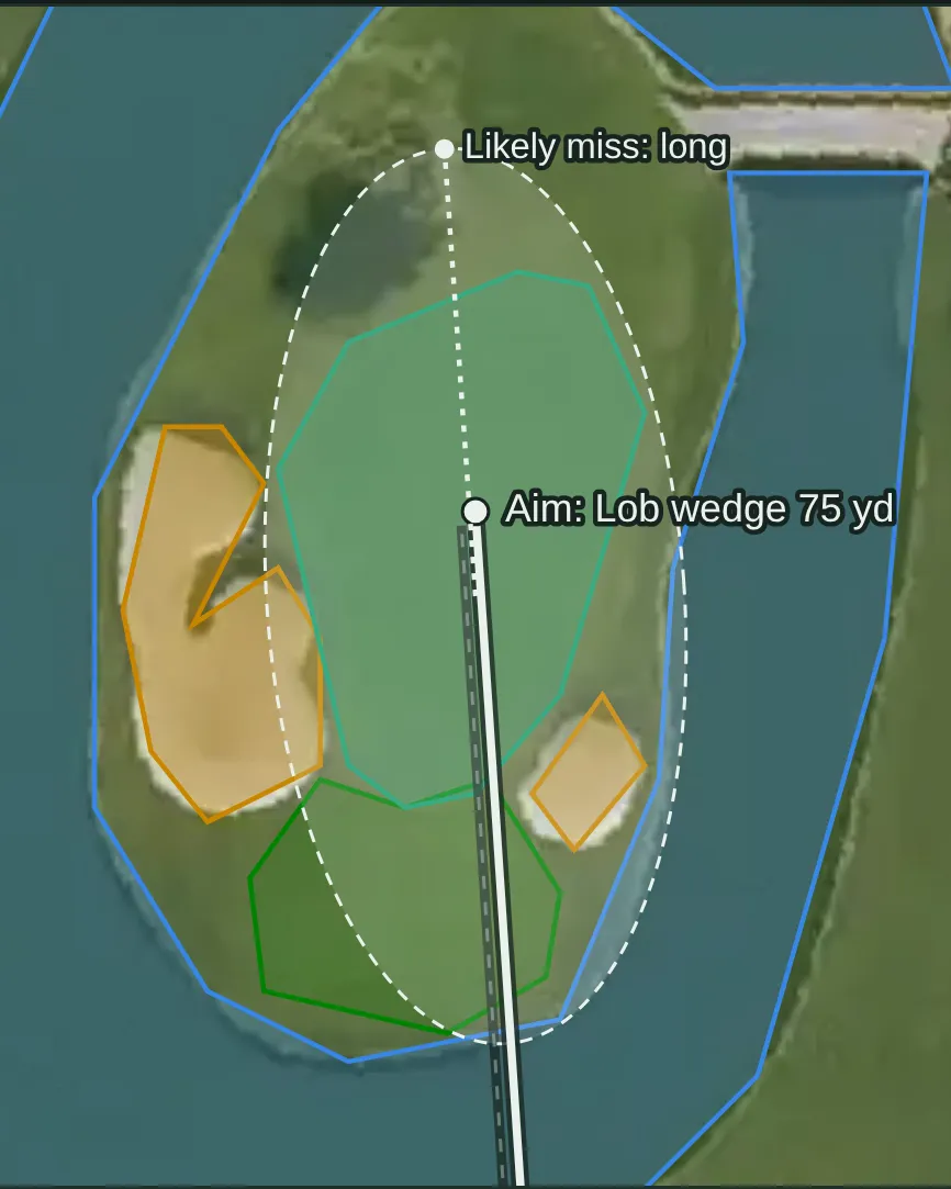
  • The approach, planned A Studio approach map on the aerial photo: a lob wedge aimed at the island green, its spread drawn as a dashed ring over the water, and the side it most often misses. Example from another course: hole 15, Resort tee, Stadium Course at TPC Scottsdale
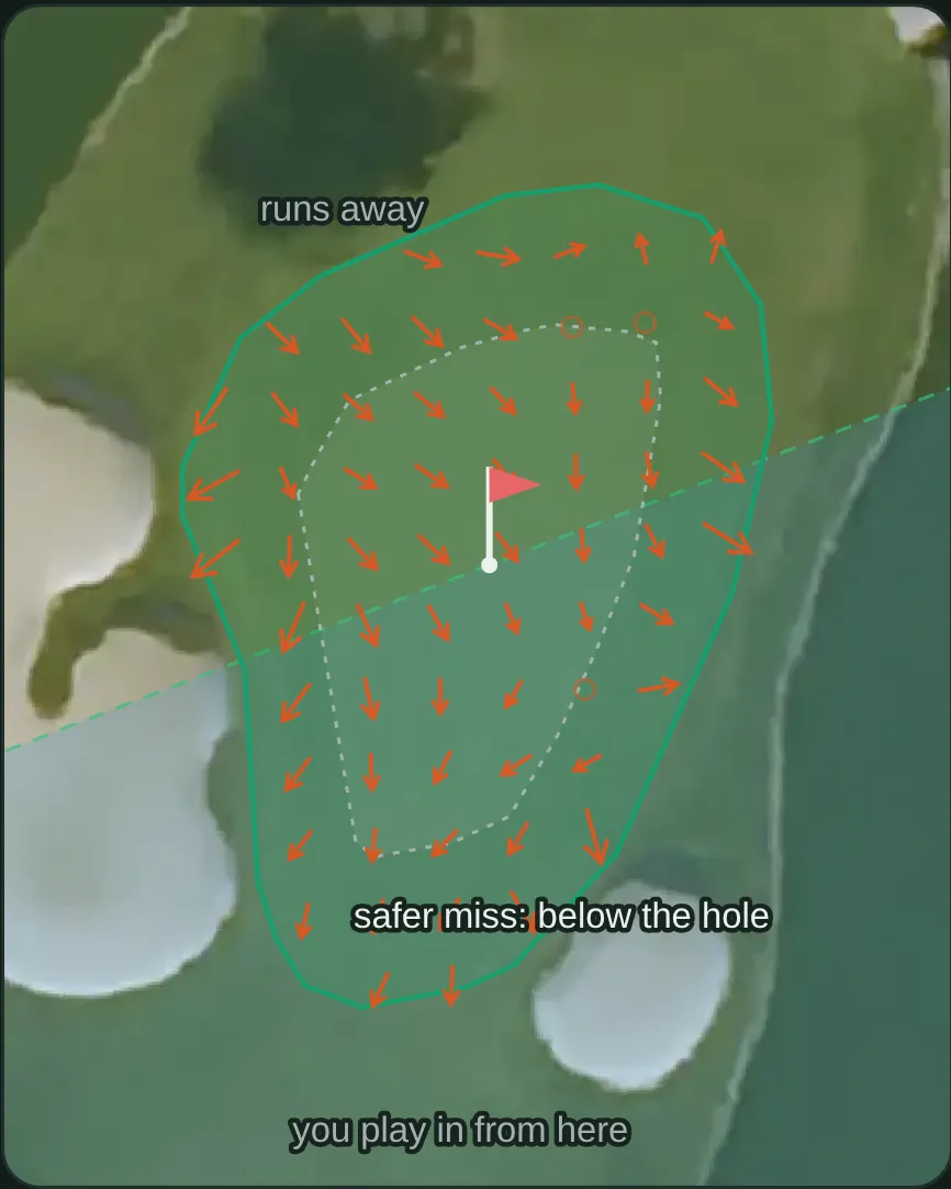
  • The green, from LiDAR A Studio green view on the aerial photo: arrows for the slope a LiDAR survey measured, the area a cup could be cut, and the safer side to miss. Example from another course: hole 15, Stadium Course at TPC Scottsdale
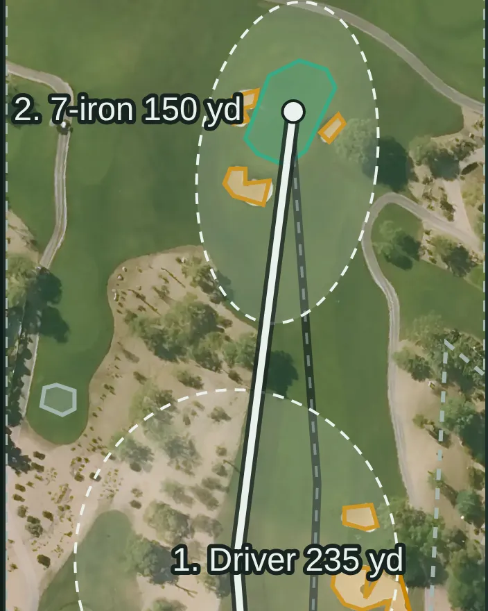
  • Every shot, tee to green A Studio plan on the aerial photo of a desert par 4: the driver off the tee and a 7-iron into the green between the bunkers, each shot with its landing spread drawn as a dashed ring. Example from another course: hole 2, Resort tee, Stadium Course at TPC Scottsdale

Plan this course in the Studio

Pictures: Studio output for a sample golfer, drawn 2026-10-15. The Studio needs a free account. AI can make mistakes.

© OpenStreetMap contributors

Book a tee time

Rates change by day and by season, so we send you to Manakiki Golf Course's own booking page rather than quoting a figure that was true the week we captured it.

Check tee times and rates

Also bookable nearby: Briardale Greens Golf Course (4.4 mi) · St. Denis Golf Course (8.9 mi)

Measured against comparable courses

How hard and how long this course plays against comparable courses — never how good it is.

FigureThis courseIn OhioNationwideAmong its peers
Longest6,656 yds153rd of 414=4,711th of 12,02524th of 62 in the Cleveland, OH metro area · =4,679th of 9,017 18-hole regulation courses
Toughest testslope 133=68th of 316=2,813th of 8,710=12th of 45 in the Cleveland, OH metro area · =2,750th of 7,089 18-hole regulation courses
Hardest from the tipsrating 73.1=72nd of 293=2,520th of 7,61513th of 42 in the Cleveland, OH metro area · =2,497th of 7,034 18-hole regulation courses
Widest tee spread1,563 yds between tees169th of 393=4,986th of 11,52322nd of 59 in the Cleveland, OH metro area · =4,914th of 8,962 18-hole regulation courses
Oldestopened 1928=81st of 355=1,550th of 9,368=12th of 48 in the Cleveland, OH metro area · =1,169th of 7,001 18-hole regulation courses
Highest above sea level790 ft derived 307th of 433=5,057th of 12,43737th of 63 in the Cleveland, OH metro area · =3,558th of 9,106 18-hole regulation courses

What's on this page

In progress4 of 6 built

4 of 6 parts of this course page are built, and we're filling in the rest.

  • Scorecard, built.Par and yardage for every hole, from 8 sets of tees.
  • Course rating and slope, built.Rated from 10 sets of tees.
  • Course map, built.All 18 greens drawn, with the fairways, bunkers and water, over aerial imagery.
  • Per-hole distances, built.Every hole is traced, so carries and distances to the front, middle and back of each green are measured along the line you actually play.
  • Green contours, not built yet.We haven't built the green contours for this course yet.
  • Course details, partly built.4 of 7 background details — we don't hold whether it is public or private, a phone number and the grass on the greens.

The site is in beta and the database is still being built, so expect gaps. Know something we don't? Help us fill it in — a link to where it's published is worth more than anything else you could send.

Sources

Gathered from the course's own site and public records — every figure on this page is traceable to who published it and when. Spot an error or a gap? Tell us.

Location and identity seeded from OpenStreetMap — © OpenStreetMap contributors, ODbL. Last checked 2026-10-24. Where each figure came from is stated beside it, above.

Compare this course →

Or go straight to a comparison: vs Stonewater Golf Club · vs Briardale Greens Golf Course · vs Lost Nation Golf Course

Nearby courses

Straight-line distance from this course's coordinates, within 60 miles — not driving distance, and it crosses state lines where the nearest courses are over one.

Know something about this course? 6 fields we don't hold — or tell us something here is wrong