Skip to content
Zomma Golf
Menu

Bandon Trails is an 18-hole resort golf course in Bandon, Oregon.

Designed by Ben Crenshaw, Bill Coore, Dave Axland. It plays 6,788 yards from the Black tees, rated 73.6/130 (checked 2026-09-27).

Create a free account to save Bandon Trails to My Game, where every course you save is measured against the rest of its state on the figures it publishes.

18
holes
71
par
6,788
yards (tips)
130
slope (black)
The shape of the round · Black teespublished figures only
HOLE ORDER — BLACK TEES392214549408133395440321567418445242401325406530182420142335445364748495104114123134144154165173184PAROUT 3,419 YDSIN 3,369 YDSFIRST NINESECOND NINE
The published card in playing order, 18 holes with the two nines split — hole number under each bar, its par below that.

The course

designer
Ben Crenshaw, Bill Coore, Dave Axland reported
access
resort
club
Bandon Dunes Golf Resort
address
57744 Round Lake Rd, Bandon, OR
phone
855-220-6710
elevation
102 ft derived
opened
2005
turf
Fescue Grass greens · Fescue Grass fairways
on site
driving range · putting green · restaurant · lessons

43.17815, -124.38557 — open on OpenStreetMap →

The course, from above

This map shows all 18 holes. 32 mapped features sit close to more than one hole and are drawn with the nearer one.

318 traced features across 8 layers for Bandon Trails, drawn over no aerial imagery.

Use arrow keys to pan, plus and minus to zoom. Tab reaches the map controls.

318 traced features across 8 layers for Bandon Trails, drawn over no aerial imagery. The map itself needs JavaScript; the geometry is a plain GeoJSON file either way.

18
Holes
18
Fairways
145
Bunkers
3
Water
18
Greens
62
Tee pads
6,788yds
Black tees
567yds
Longest hole
133yds
Shortest hole

Imported from OpenStreetMap, edges unchecked

Tees & ratings

Ratingsopen datachecked 2026-09-27

All 9 tee sets par, yardage, course rating, slope — the full table

Sorted by Yards, descending. 9 rows, showing the start of the table.

BlackM71678873.613034193369
GreenM71624971.112931293120
GreenF71624977.613831293120
GoldF71575174.613228592892
GoldM71575168.712228592892
OrangeM71509766.111725132584
OrangeF71509770.812225132584
Royal BlueF71393763.8105
Royal BlueM71393761.2105

Every figure as published; a blank cell is one nobody publishes. Front 9 and Back 9 are summed from the per-hole yardages on the scorecard.

Scorecard

Scorecardopen datachecked 2026-09-27

Hole 123456789101112131415161718 Total
Par 435434445443444534 71
Black 392214549408133395440321567418445242401325406530182420 6,788
Green 356166532365124359406299522393429235374306367494159363 6,249
Gold 288142513334114315373283497369398220354292323466138332 5,751
Orange 21284455315104293351243456326382192308251296437128264 5,097
Handicap 131735159711110418121482166

No per-hole yardages are published for Royal Blue, so it is not on the card above.
The Studio

The Studio can't plan Bandon Trails hole by hole yet.

We hold its scorecard and 318 traced features, but not a model of every green, which a plan aims at.

It plans 4,578 courses hole by hole today, and it charts your bag anywhere.

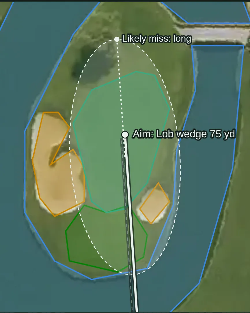
  • The approach, planned A Studio approach map on the aerial photo: a lob wedge aimed at the island green, its spread drawn as a dashed ring over the water, and the side it most often misses. Example from another course: hole 15, Resort tee, Stadium Course at TPC Scottsdale
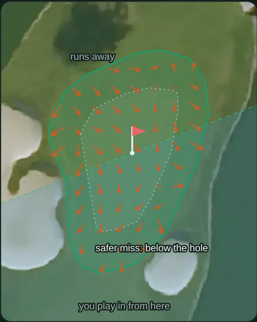
  • The green, from LiDAR A Studio green view on the aerial photo: arrows for the slope a LiDAR survey measured, the area a cup could be cut, and the safer side to miss. Example from another course: hole 15, Stadium Course at TPC Scottsdale
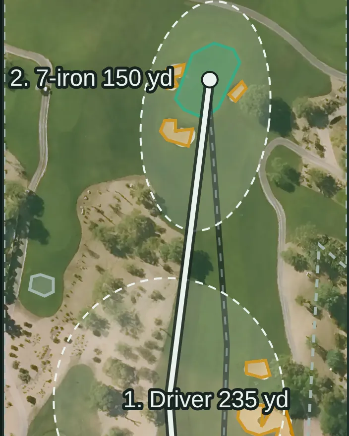
  • Every shot, tee to green A Studio plan on the aerial photo of a desert par 4: the driver off the tee and a 7-iron into the green between the bunkers, each shot with its landing spread drawn as a dashed ring. Example from another course: hole 2, Resort tee, Stadium Course at TPC Scottsdale

See the courses it plans Open the Studio

Pictures: Studio output for a sample golfer, drawn 2026-10-15. The Studio needs a free account. AI can make mistakes.

© OpenStreetMap contributors

Book a tee time

Rates change by day and by season, so we send you to Bandon Trails's own booking page rather than quoting a figure that was true the week we captured it.

Check tee times and rates

Also bookable nearby: Bandon Dunes (0.9 mi) · Sheep Ranch (2.7 mi)

Measured against comparable courses

How hard and how long this course plays against comparable courses — never how good it is.

FigureThis courseIn OregonNationwideAmong its peers
Longest6,788 yds9th of 41=3,618th of 12,025281st of 601 resort courses · =1,705th of 7,004 courses you can book · =3,593rd of 9,017 18-hole regulation courses
Toughest testslope 130=8th of 30=3,777th of 8,710=298th of 477 resort courses · =1,625th of 4,936 courses you can book · =3,684th of 7,089 18-hole regulation courses
Hardest from the tipsrating 73.65th of 29=1,853rd of 7,615=151st of 446 resort courses · =772nd of 4,145 courses you can book · =1,838th of 7,034 18-hole regulation courses
Widest tee spread2,851 yds between tees3rd of 40415th of 11,52335th of 593 resort courses · 197th of 6,653 courses you can book · 409th of 8,962 18-hole regulation courses
Oldestopened 200531st of 32=8,800th of 9,368=468th of 516 resort courses · =5,205th of 5,526 courses you can book · =6,554th of 7,001 18-hole regulation courses
Highest above sea level102 ft derived 30th of 42=9,972nd of 12,437476th of 616 resort courses · =6,115th of 7,274 courses you can book · =7,184th of 9,106 18-hole regulation courses

What's on this page

In progress5 of 6 built

5 of 6 parts of this course page are built, and we're filling in the rest.

  • Scorecard, built.Par and yardage for every hole, from 7 sets of tees.
  • Course rating and slope, built.Rated from 9 sets of tees.
  • Course map, built.All 18 greens drawn, with the fairways, bunkers and water. We haven't put aerial photography under it yet.
  • Per-hole distances, built.Every hole is traced, so carries and distances to the front, middle and back of each green are measured along the line you actually play.
  • Green contours, not built yet.We haven't built the green contours for this course yet.
  • Course details, built.All 7 background details — architect, year opened, access, contact and grass.

The site is in beta and the database is still being built, so expect gaps. What's left on this course is ours to build rather than ours to be told — it comes from mapping and survey data, not from a form. Coverage sets out where the whole database stands.

Sources

Gathered from the course's own site and public records — every figure on this page is traceable to who published it and when. Spot an error or a gap? Tell us.

Location and identity seeded from OpenStreetMap — © OpenStreetMap contributors, ODbL. Last checked 2026-09-27. Where each figure came from is stated beside it, above.

Compare this course →

Or go straight to a comparison: vs Bandon Dunes · vs Pacific Dunes · vs Old Macdonald

Nearby courses

Straight-line distance from this course's coordinates, within 60 miles — not driving distance, and it crosses state lines where the nearest courses are over one.

Know something about this course? 3 fields we don't hold — or tell us something here is wrong