Skip to content
Zomma Golf
Menu

Lindsay Municipal Golf Course is a 9-hole course in Lindsay, Oklahoma.

It plays 3,294 yards from the White tees, slope 118 (checked 2026-08-15).

Create a free account to save Lindsay Municipal Golf Course to My Game, where every course you save is measured against the rest of its state on the figures it publishes.

9
holes
36
par
3,294
yards (tips)
118
slope (white)
The shape of the round · White teespublished figures only
HOLE ORDER — WHITE TEES185522390479482345372179340132534445564748394PAROUT 1,576 YDSIN 1,718 YDSFIRST NINESECOND NINE
The published card in playing order, 9 holes with the two nines split — hole number under each bar, its par below that.

The course

address
Lindsay, OK, 73052
elevation
1,096 ft derived
opened
1958

34.87252, -97.63369 — open on OpenStreetMap →

The course, from above

This map shows all 9 holes, their lines predicted by a model from USDA NAIP aerial imagery and numbered against the scorecard. Its greens and fairways are predicted the same way. The course outline is predicted too, drawn around the predicted holes and wide of the mown ground, so the real property line may sit wider or tighter.

27 features across 4 layers for Lindsay Municipal Golf Course, all 27 predicted by a model, drawn over NAIP 2021 aerial imagery.

Use arrow keys to pan, plus and minus to zoom. Tab reaches the map controls.

27 features across 4 layers for Lindsay Municipal Golf Course, all 27 predicted by a model, drawn over NAIP 2021 aerial imagery. The map itself needs JavaScript; the geometry is a plain GeoJSON file either way.

© OpenStreetMap contributors · Holes and outlines predicted by a model trained on OpenStreetMap data · GeoJSON

Holes and outlines predicted from USDA NAIP imagery · Contains information from SatlasPretrain, which is made available under the ODC Attribution License

9
Holes · predicted
8
Fairways · predicted
9
Greens · predicted
3,294yds
White tees
522yds
Longest hole
179yds
Shortest hole

All 27 predicted by a model from aerial imagery, hole lines and edges unchecked · USDA NAIP 2021-05-29

Tees & ratings

Ratingsopen datachecked 2026-08-15

All 2 tee sets par, yardage, slope — the full table

Sorted by Yards, descending. 2 rows.

WhiteM363294118
RedF37contested362989125

Every figure as published except Card par (derived), which is summed from the card below and shown only where a published figure is contested; a blank cell elsewhere is one nobody publishes.

The Red tees publish a par the scorecard below does not add up to. Both figures are published and nothing we hold settles which one a round plays to, so the Par column keeps the published figure, marked contested, and each tee's own par row from the card below is summed beside it, marked derived.

Scorecard — every published tee

Scorecardopen datachecked 2026-08-15

Hole 123456789 Total
Par 354454434 36
White 185522390479482345372179340 3,294
Red 165425350479400345345140340 2,989
Handicap 1131317915517

The Studio

The Studio can't plan Lindsay Municipal Golf Course hole by hole yet.

We hold its scorecard and 27 of its features, all 27 predicted by a model, but not a model of every green, which a plan aims at.

It plans 4,579 courses hole by hole today, and it charts your bag anywhere.

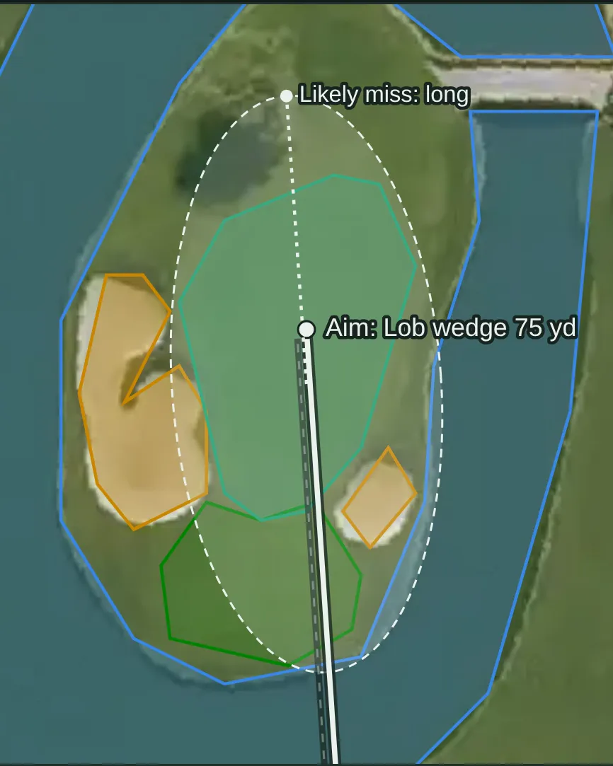
  • The approach, planned A Studio approach map on the aerial photo: a lob wedge aimed at the island green, its spread drawn as a dashed ring over the water, and the side it most often misses. Example from another course: hole 15, Resort tee, Stadium Course at TPC Scottsdale
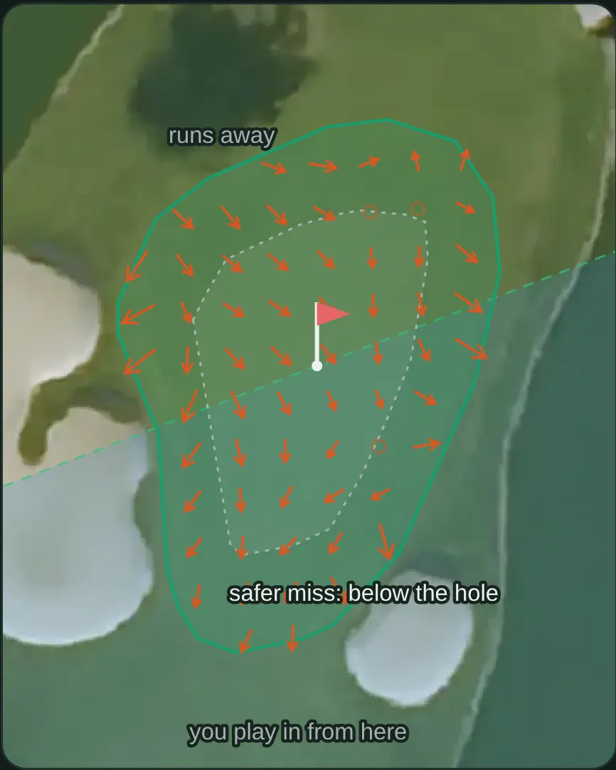
  • The green, from LiDAR A Studio green view on the aerial photo: arrows for the slope a LiDAR survey measured, the area a cup could be cut, and the safer side to miss. Example from another course: hole 15, Stadium Course at TPC Scottsdale
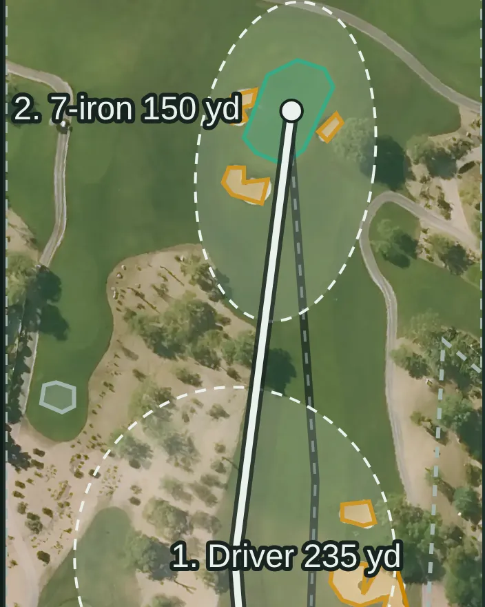
  • Every shot, tee to green A Studio plan on the aerial photo of a desert par 4: the driver off the tee and a 7-iron into the green between the bunkers, each shot with its landing spread drawn as a dashed ring. Example from another course: hole 2, Resort tee, Stadium Course at TPC Scottsdale

See the courses it plans Open the Studio

Pictures: Studio output for a sample golfer, drawn 2026-10-15. The Studio needs a free account. AI can make mistakes.

© OpenStreetMap contributors

Book a tee time

Rates change by day and by season, so we send you to Lindsay Municipal Golf Course's own booking page rather than quoting a figure that was true the week we captured it.

Check tee times and rates

Also bookable nearby: Winter Creek Golf Country Club (14 mi) · River Bend Golf Club South Course (20 mi) · River Bend Golf Club North Course (21 mi) · Cobblestone Creek Golf Club (23 mi)

Measured against comparable courses

How hard and how long this course plays against comparable courses — never how good it is.

FigureThis courseIn OklahomaNationwideAmong its peers
Longest3,294 yds129th of 183=9,694th of 12,025=310th of 1,791 9-hole regulation courses
Toughest testslope 118=94th of 128=6,934th of 8,710=405th of 972 9-hole regulation courses
Widest tee spread305 yds between tees162nd of 174=10,914th of 11,523=1,346th of 1,640 9-hole regulation courses
Oldestopened 1958=51st of 149=2,734th of 9,368=564th of 1,347 9-hole regulation courses
Highest above sea level1,096 ft derived 77th of 185=2,923rd of 12,437=609th of 1,830 9-hole regulation courses

What's on this page

In progress3 of 6 built

3 of 6 parts of this course page are built, and we're filling in the rest.

  • Scorecard, built.Par and yardage for every hole, from 2 sets of tees.
  • Course rating and slope, not built yet.We don't have a course rating or slope for this course yet.
  • Course map, built.All 9 holes and their greens are drawn, predicted by a model from aerial imagery and shown over it.
  • Per-hole distances, built.Every hole's line of play is predicted from aerial imagery, so carries and distances to the front, middle and back of each green are measured along that predicted line.
  • Green contours, not built yet.We haven't built the green contours for this course yet.
  • Course details, partly built.2 of 7 background details — we don't hold the architect, whether it is public or private and a phone number, and 2 more.

The site is in beta and the database is still being built, so expect gaps. Know something we don't? Help us fill it in — a link to where it's published is worth more than anything else you could send.

Sources

Gathered from the course's own site and public records — every figure on this page is traceable to who published it and when. Spot an error or a gap? Tell us.

Location and identity seeded from OpenStreetMap — © OpenStreetMap contributors, ODbL. Last checked 2026-08-15. Where each figure came from is stated beside it, above.

Compare this course →

Or go straight to a comparison: vs Winter Creek Golf Country Club · vs Brent Bruehl Memorial Golf Course · vs River Bend Golf Club South Course

Nearby courses

Straight-line distance from this course's coordinates, within 60 miles — not driving distance, and it crosses state lines where the nearest courses are over one.

Know something about this course? 14 fields we don't hold — or tell us something here is wrong